3.1 Briarhill
Download PDF of the Briarhill Urban Framework Plan
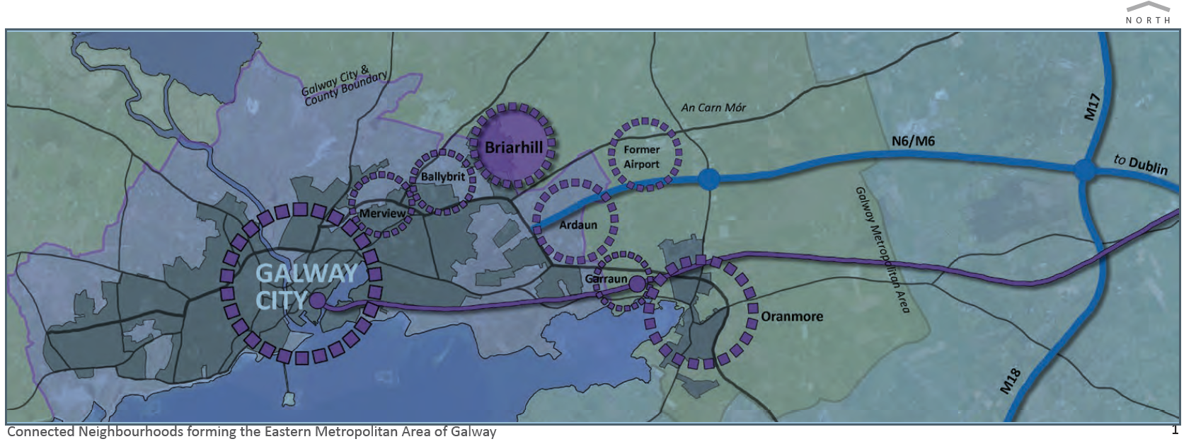
Briarhill is strategically located in the heart of the eastern Galway Metropolitan Area within 5km of Galway City and immediately adjoining the county boundary with Galway City. Briarhill is most strongly associated with its extensive employment base at Briarhill Business Park, Galway Technology Park and at Parkmore East and West. These currently mark the eastern extent of the employment corridor leading from the city to Briarhill.
While the Industrial Development Authority (IDA) retains ownership of substantial expansion lands for its Parkmore East facility, Briarhill also includes significant lands that are suitable for urban growth and the provision of new residential development.
At present, the N6 road effectively marks the boundary between residential and employment uses at the north eastern Galway suburbs. The residential areas of Doughiska, Ballybrit, Mervue and Ballybane all lie within the enclosure of the N6 corridor whereas the employment bases at Briarhill and Ballybrit Business Park are on the outside.
The planned Galway City Ring Road (GCRR) will alter the manner in which vehicular traffic traverses and accesses the eastern Galway Metropolitan Area. The existing N6 leading to the R339 Monivea Road will be free from through traffic crossing the city and will present a substantial opportunity for urban expansion across the current divide.
Briarhill has ample green field lands available to cater for urban growth and can be plan-led from the outset ensuring a sustainable development model is delivered in a phased manner in the short, medium and longer term. Briarhill can continue to grow its employment base while also providing the balancing residential growth necessary to ensure a sustainable development model underpins the growth and vision for the Metropolitan Area.
This Framework Plan sets out the vision, principles and framework that will guide the orderly and sustainable development of high quality compact growth at Briarhill in the Metropolitan Area.

Continue reading: download PDF of the Barnhill Urban Framework
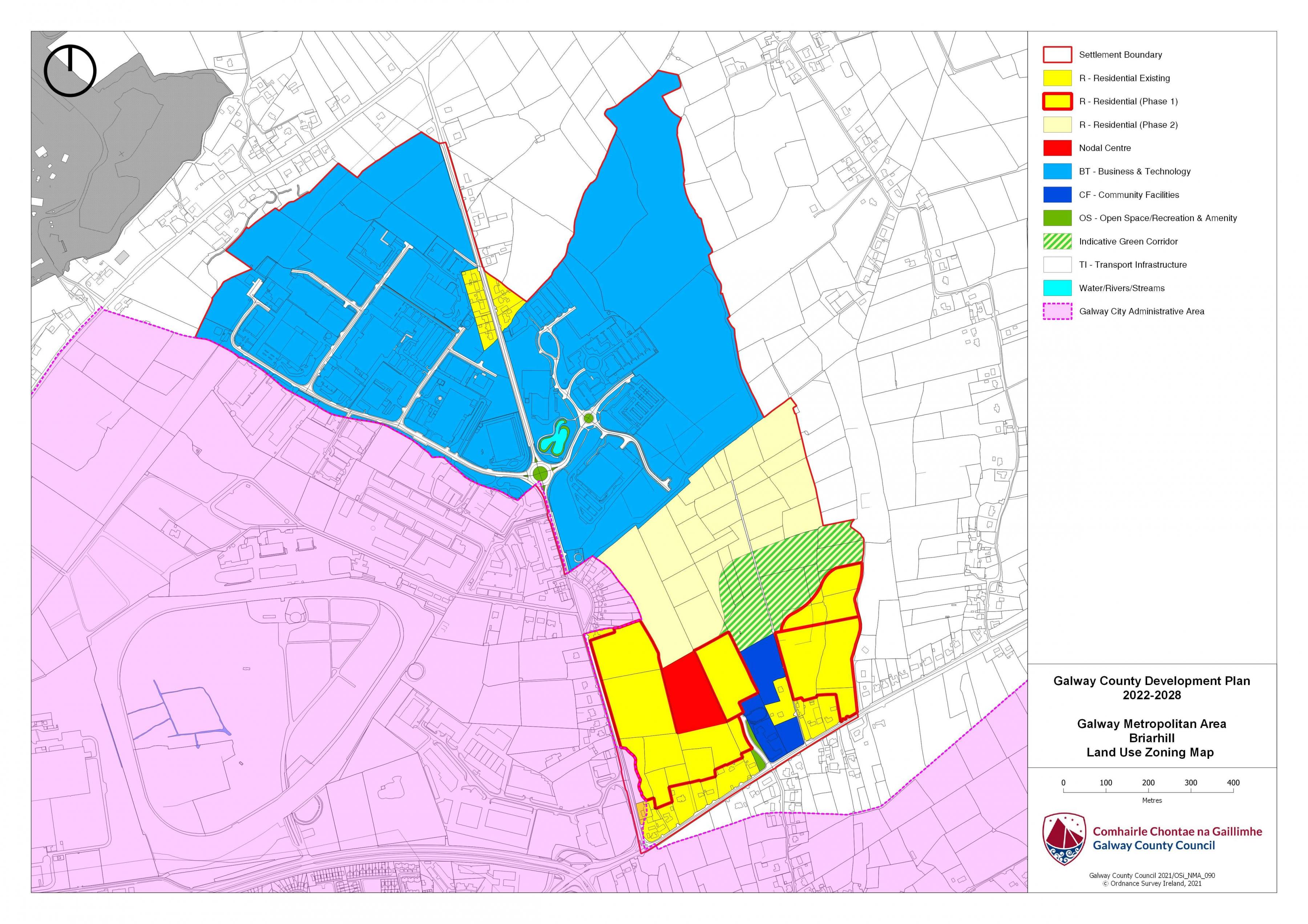
Briarhill Land Use Zoning Map

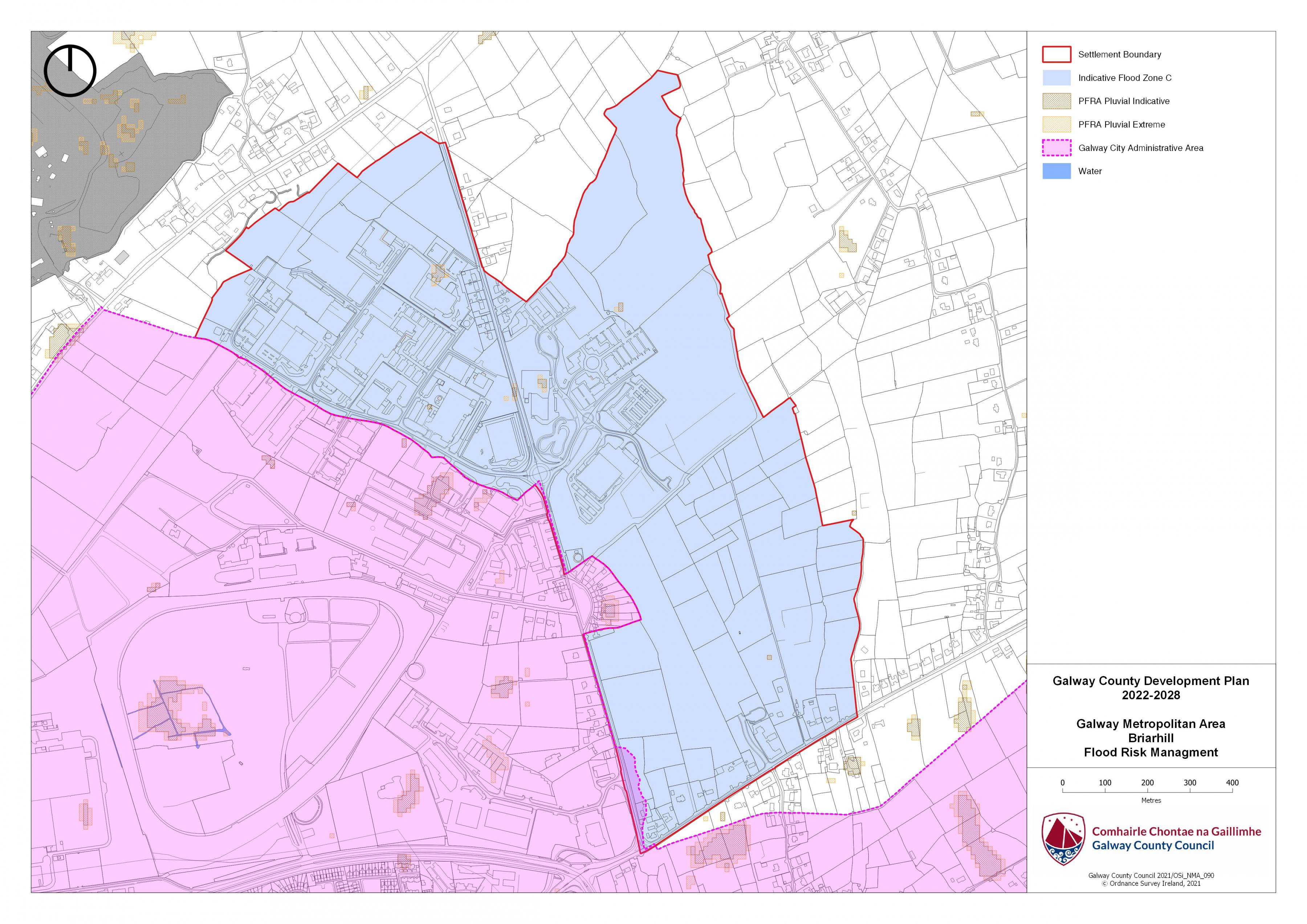
Briarhill Flood Risk Management Map

